 Helen Chick

Antarctica is big. Really big. You just won’t believe how vastly, hugely, mind-
Although I had loaded some maps of Antarctica onto my phone, I didn’t really get a sense of perspective from these, nor were they detailed enough for my satisfaction. I have just spent some time pfaffing around on Open Street Maps and Wikipedia trying to figure out what was where for the places we went, but very few spots are named (and some of them aren’t named correctly, despite my best efforts to update OSM). Here, then, are some maps to help you understand where we went (well, to help me mainly!)
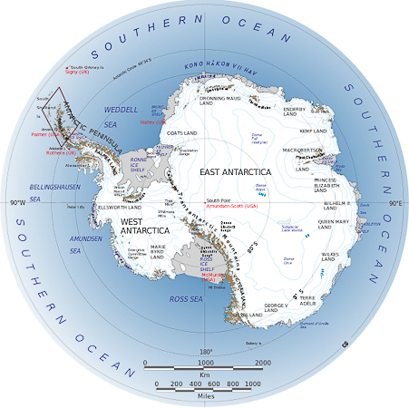
The first map shows all of Antarctica. If you try looking at Antarctica on Google Maps you’ll get no idea of its size or shape because it is smeared across the bottom of the page thanks to the projection being used. Antarctica is about 1.5 times the area of Australia. The northern end of the Antarctic Peninsula is 1000km from the bottom of South America (the bit of the Antarctic Peninsula that we visited is highlighted on the upper left).
An amusing thought crossed my mind as I pondered the map below. It’s missing a traditional NSEW compass rose. How should it be oriented, and what should it look like? 🙂 [The map is a public domain map produced by NASA, sourced from Wikipedia.]
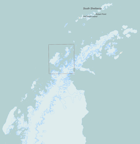
Here is a closer view of the Antarctic Peninsula. We visited the South Shetlands on our way home; I will report on this—including a significant event—later in the blog. Most of our time, however, was spent within the highlighted rectangle. We didn’t get as far south as the Antarctic Circle, and so despite being down there for summer solistice/the longest day of the year, we didn’t have 24 hour sunshine. It didn’t seem to get totally dark overnight, though. [Source: Open Street Maps, with my annotations.]
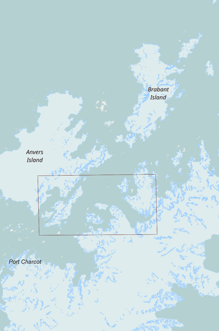
In fact, apart from a visit to Port Charcot, we spent most of our time pottering our way around the rather small region highlighted within the map below. [Source: Open Street Maps.]
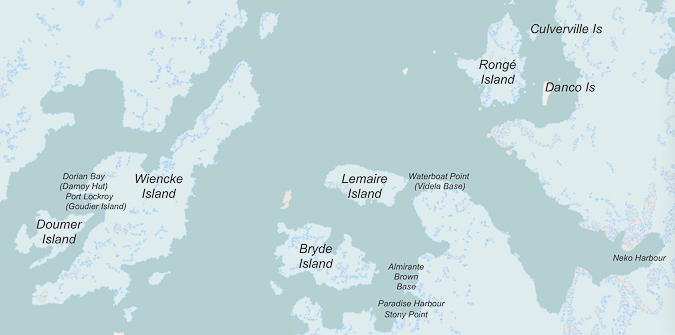
In hindsight I’m annoyed I didn’t make the effort to get more of an idea of what was where while I was down there … although, to be honest, I was too busy being there and enjoying it all. Nevertheless, I wish I’d had the map below … and realised earlier in the voyage that there was a reasonable one pinned up on the ship! Basically, out of the 13 million square kilometres that make up Antarctica we saw a few highlights within this 60km x 30km region! This is like saying you’ve visited Australia, when you’ve only seen bits within the Hobart-New Norfolk-Orford triangle. You sort of feel a bit insignificant, and you realise that you’ve seen hardly anything at all. Mind you, there might be some who say “If you’ve seen one ice-covered mountain, you’ve seen them all” … but that would not be me.
[Source: Open Street Maps, with my annotations/corrections. Unlike OSM, I think I have named Wiencke, Doumer, and Goudier Islands correctly. The maps on Google name hardly anything and their topography is poor.]
In most of the blog entries about the trip I have included fairly accurate coordinates for things, so if you paste them into Google maps, particularly with satellite view turned on, you’ll get more of an idea where we went. You may have to zoom out a little to get the best perspective of the landmarks.
* Yes. Yes. This is a Douglas Adams quote, plagiarised, and with “Antarctica” in place of the original “Space”.
Latest comments