 Helen Chick

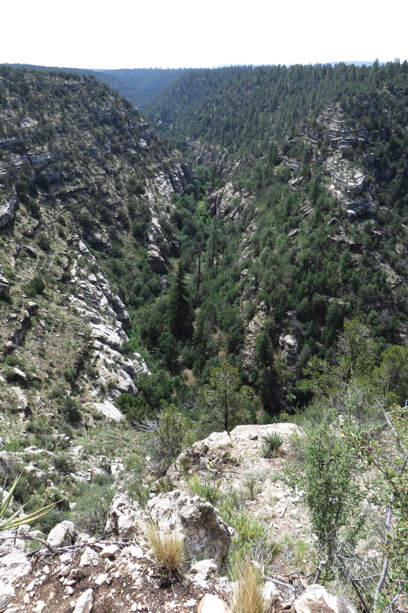
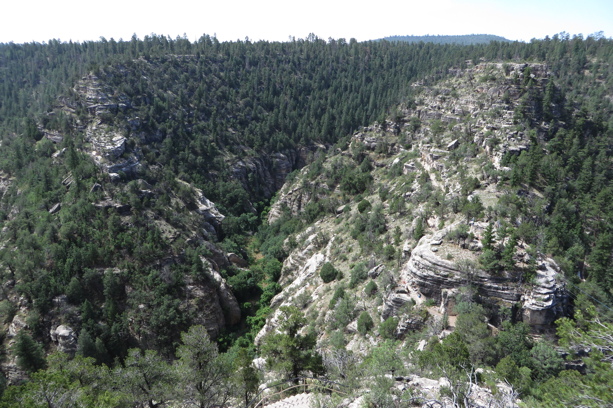
The first part of our final day of seeing the sights around Flagstaff was spent visiting Walnut Canyon National Monument. Here a narrow canyon twisted through the landscape, almost making an island out of a central outcrop (see the second photo below). The canyon’s narrow floor was far below us (over 100m away) and devoid of water (not least because the river has been diverted to be help supply Flagstaff with water), and it could barely be seen anyway because of the narrowness of the canyon and the number of trees growing up from it. It’s worth getting a satellite view of the location, or, better yet, check out the contours (35.1715, -111.5086).
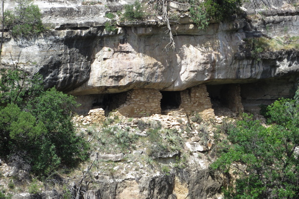
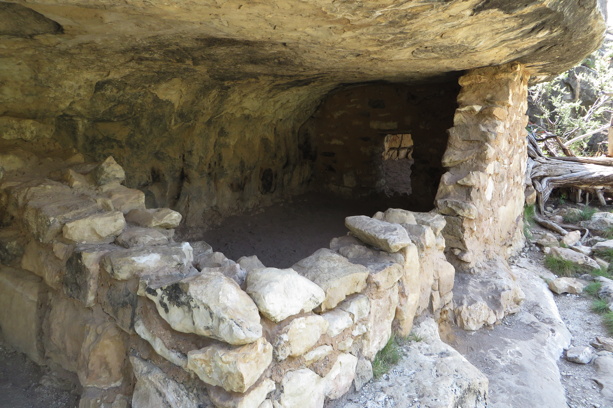
However, it wasn’t merely the dramatic landscape that was the attraction here. The Sinagua people had also made this area their home at times, by taking advantage of the overhangs of the cliffs and building stone rooms, partly for living in but also for storing crops and water.
As we followed the trail down onto the island, Noleine and I marvelled at the precariousness of this existence and the perils of having toddlers and sleepwalkers, while also jokingly trying to determine which were the “upper class” locations among the scattered sets of dwellings. The access path takes you past some of the overhangs and rooms, although much of this is restored structure rather than original, thanks to damage over the years.
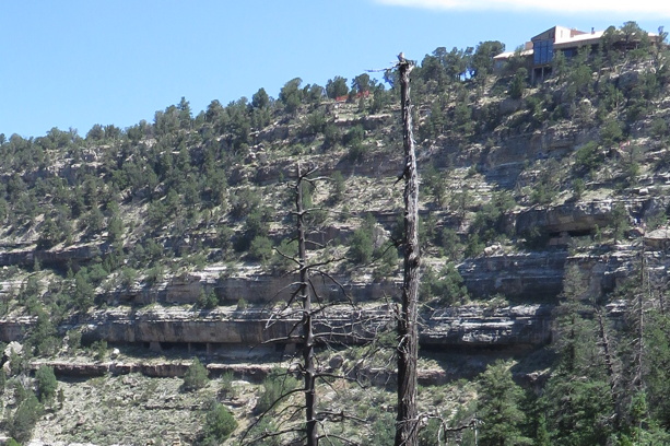
The people would have had to be fit, as there are no easy routes across, up and down the cliff-faces. Just going out to tend the crops and returning each night would have been exercise enough, but to get materials and supplies from either above or below to the mid-level pueblos would be another level of difficulty again. If you look carefully at the photo below you can just make out the tourist walk from the visitors’ centre down to the saddle/isthmus that provides access to the island outcrop seen in the right of the second photo shown above. We had the advantage of concrete steps and handrails. 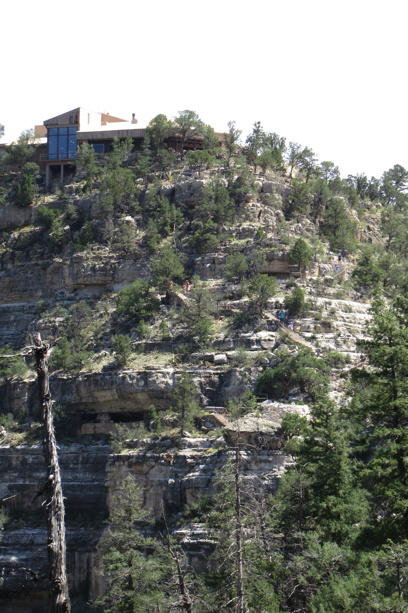
It was really hard to capture the full 3D expanse of this seemingly small area, but for the photo below I am standing on the “island” looking at the upper end of the canyon, with the visitors’ centre on the rim. As you can just see in the enlargement that follows, there are more dwellings tucked in under the dominant dark overhang.
Not a place I’d really care to live, despite the impressive views! (Maybe that’s what the Sinagua concluded, because no one is entirely sure why they left the area). 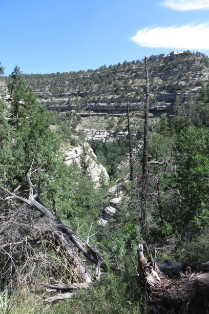
Latest comments