(Good grief, the heading is in APA style: note the comma before the “and”! I cannot escape my work! This holiday is too short!)
Thursday 1 Oct
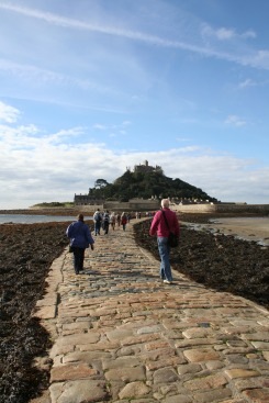
This morning I visited St Michael’s Mount, which is one of those places that reminds you how geography can have such an influence on history, sociology and economy. It is a tidal island, off the coast of Marazion near Penzance, and at high tide it is cut off from the mainland. At low tide, however, there is a stone causeway and it is possible to walk across or even drive a car (workers only). The photo on the left shows the mount in the morning just before I walked across the causeway; the photo on the right was taken at dusk (hence the underexposure) when the tide was high. There are boats that take passengers across when the causeway is wet.
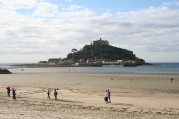
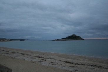
 Actually, I’ve just looked at those photos again, and they aren’t convincing at all! You can just see the causeway in the first one, but the second one doesn’t clearly show that the island is now cut off. I know it is, which just highlights our capacity to see what we think we ought to see.
[And while I am sidetracked, I have to say that I’ve never been able to work out why “tourist attractions” don’t open until 10am … or even later (10:30 for the castle part of St Michael’s Mount). They should open earlier, so that people like me—who can’t stand it when an hour or more of the morning just disappears when there is so much to see and do—can get there at the beginning of the day and avoid the madding crowd. Alternatively perhaps it should be arranged so that work doesn’t start until 10am so that we can get used to this late start idea!]
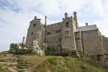
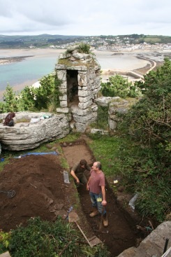
I decided to take a tour of the castle, although we were not permitted to take photos inside 🙁 . At various times in its history it has been monastery, castle, and residence, and there are remnants of all of these phases of its life. There are renovations and upgrades taking place at the moment (glad it’s not me paying the maintenance bill … no, wait, I presume my entry fee contributed!), and, as you can see in the photo below: “oooh, errrrr, there’z a noice bi’ o’ archaeology ‘ere” (Time Team, in case my transcribed accent isn’t coming through clearly!)
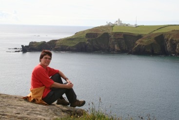 My next point of call was the town of Lizard. “Why ‘Lizard’?” I hear you ask. “Well,” I reply, “it’s right next to Lizard Point on the Lizard Peninsula” which is singularly unhelpful—not to mention obvious—but the best that I can do. Here the strategic location of two caches on either side of the point meant that I walked along some of the South West Coast path (a path that follows the entire coast of Cornwall or near enough) right around Lizard Point which is the most southerly point of England (N 49° 57.535 W 5° 12.389 according to my GPSr). In terms of tourist overkill this wasn’t quite as bad as Land’s End (and, besides, having been to the more westerly Isles of Scilly,who needs Land’s End anyway?!), and I feel I have experienced Lizard Point more legitimately, because I walked around it. Once you’ve gone beyond 200m either side of it you have escaped most of the tourists. The photo at right was taken about 1km around the coast from the Lizard Lighthouse, and there was hardly anyone around here apart from the occasional more serious walker. It was a good place for a cache … which is why someone had put one there!
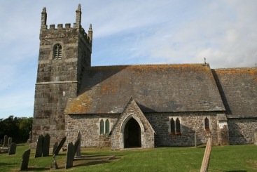
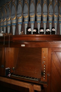
It was late enough in the day by this stage that it wasn’t worth driving to a distant additional “big attraction” and so I checked my GPSr for nearby caches. This brought me to the tiny village of Grade and the church of St Grada (N 49° 59.097 W 005° 11.594). The tower dates back to the 13th century, and is made from the serpentine stone of the area, while the main part of the church was rebuilt in the 1860s. What is slightly weird is that the church sits out on its own by a field at the end of a lane, far removed from any likely parishioners. It seems to be well-loved, however, because someone very recently had given the lawns a severe trim. There are some cute interior touches, in addition to the more regular ecclesiastical accoutrements. In among the pipes above the organ manual are various stuffed toy animals, including some mice and a set of loopy looking owls, as can be seen in the leftmost of the photos below.
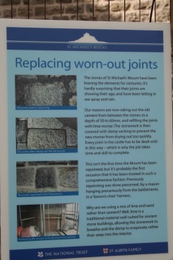
And while I’m on the subject of slightly amusing things, the sign in the middle (or right, depending on your browser window size) was spotted at St Michael’s Mount. My knees were “feeling it” a bit today, especially after the hike up the steep path of the mount, and so this caught my eye! (In case it’s not clear, the sign is referring to the mortar between the blocks of stone which has become eroded over the years.) [And, to get further diverted, although I agree with the British nomenclature board’s support for the use of apostrophes, I confess to being somewhat bemused by their approval of a town named “Westward Ho!” complete with the exclamation mark. Watch me create punctuation havoc: “As I drove past the towns of Westward Ho!, Bude, Northam, and Barnstaple I was perplexed by Westward Ho!’s use of the exclamation mark in its name. Fancy calling a town ‘Westward Ho!’!”]
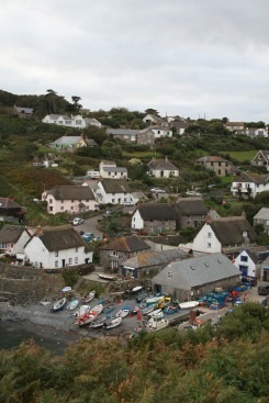
 Now … where was I? Ah, yes. My second last port of call was the small village of Cadgwith (shown in the third photo above), nestled in a tiny cove where the roads are so few and narrow and steep that you have to park at the top and walk down. Apart from the thatched roofs, this port was particularly reminiscent of Newfoundland. There’s a nearby feature called “The Devil’s Frypan”, which is very much like Tasmania’s similarly named “Devil’s Kitchen”, where the inland end of a sea cave has collapsed, leaving a hole in the ground with the sea coming in through the remaining arch. Newfoundland has one of these too: I think it’s called “The Dungeon” near Bonavista.
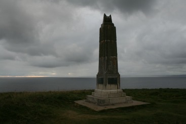
And speaking of Newfoundland, my last stop was to do the other “end” of a place I’d been to in Newfoundland over 10 years ago. The top of Signal Hill in St John’s Newfoundland is where Marconi received the first trans-Atlantic radio message back in 1901. The Cornish village of Poldhu is where it all began: the three dots of the S began their journey across the ocean on the cliff tops here. We’ve come a long way since then.
Some additional photos of the day’s activities can be found by clicking here.
 Helen Chick
Latest comments