Wednesday 30 Sep
I got sunburnt in September (nearly October) on a white sandy English beach. How’s that for another impossible thing?!
I spent the day on St Mary’s, one of the Isles of Scilly, and on my way home—by helicopter—we landed on Tresco to pick up some passengers. These are two of the five inhabited islands in the Scillonian archipelago, but given the large number of islets, it’s hard to tell how fractionally Scilly this visit was. Who cares; I had fun!
The day started early: I had to be at the heliport at 6:45 for a 7:30 flight. My original plan had been to go to the Isles of Scilly by boat, but the thought of a day in which 5 hours were used up in getting there and back did not appeal. Not only does the helicopter only take 20 minutes each way for the 28 mile journey (yes, it is a very slow boat!) but British International must be one of the few airline companies that leave early if everyone is there. Mind you, I have just discovered that Sikorsky S61 helicopters have been around longer than I have, which is vaguely disconcerting especially if their joints are anything like mine are at the moment after a day of lots of walking and cycling (I’m not sure if BI’s current helicopters are that old … but the model certainly is). The photos below were taken on the return journey in the afternoon when the sun had finally appeared after an overcast morning that played havoc with the exposure settings for my photos … and when my side of the helicopter had the best views of the islands.
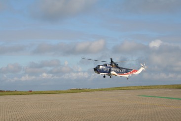
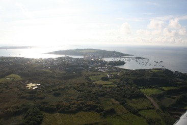
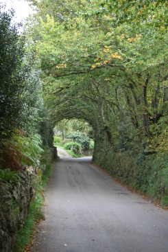
St Mary’s is kind of like Maria Island, Rottnest Island, Phillip Island and Prince Edward Island rolled into one, with Cornish lanes thrown in for good measure (it’s too bucolic and placid to be much like Newfoundland). At 3 miles in diameter the best way to get around is by bike, but with one’s hearing aids turned up so as to hear any traffic around the blind corners, since there are still cars and buses about … and pensioners on motorised chairs. I hired a bike, but didn’t bother with a bike lock: you just leave the bike lying around and it’ll be there when you get back.
None of the roads are labelled. I presume this is because the locals know them all and, of course, there aren’t that many. However this lack of labelling is a bit annoying if your map has named roads and you’re using it to work out where to go. I had a GPSr, which is really useful because it can tell you exactly where you are, but it’s a bit difficult to refer to it while keeping both hands on the handlebars and your eyes on the road (and your ears on the hint of oncoming traffic). There are a few hills but, of course, there aren’t that many … although there was one which needed granny gears (or perhaps it wouldn’t have if only I wasn’t so unfit!).
At this time of year the place is full of twitchers (bird watchers), but it was easy enough to find quiet peaceful places most of the time. I couldn’t avoid all of them, however. I was a little annoyed by the two people who conspired to place themselves in the one place I wanted to be, and didn’t budge in the half-hour that was all I could afford to wait. Yes, they were unknowingly sitting on top of a cache I was seeking!
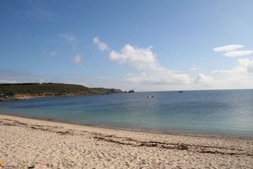
The existence of white beaches would be a surprise to those who know the more typical colours (and rockinesses) of much of the English coast, although white/yellow sand is quite common in Cornwall (it’s just that you’ll get charged a fortune in parking fees if you ever want to get near it!).
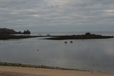
As suggested earlier, the morning and the afternoon were quite a contrast, and not only in terms of the weather. The first pair of photos below shows a beach near Hugh Town. They’re not taken from exactly the same spot or at the same zoom setting, but the islet on the right in the first photo is but a dangerous exposed rock on the right. (Yes, my horizons are doing their non-horizontal thing again. They do this from time to time. The boat that was in the first picture has simply slid sideways off to the left.)
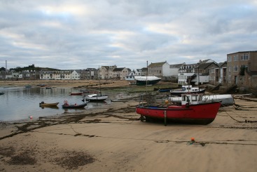
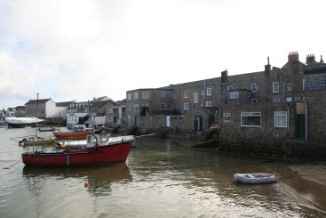
The second pair of photos shows the harbour at Hugh Town. In the morning the boats are beached and you can see that most of them have their sea-legs set: these are poles attached to either side of the boat to stop them falling over. I learned about sea-legs from reading Arthur Ransome’s Great Northern?. This is yet another example of how one picks up trivia through a diverse and eclectic/eccentric reading regime.
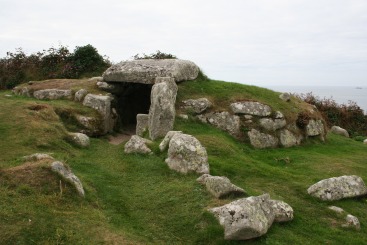
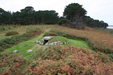
One of the highlights of my visit was to encounter some Bronze Age burial mounds. These burial sites date back to 2000BC or so. The one on the left is known as Bant’s Carn and there are the remains of a village nearby as well where you could make out the individual rooms (I was wondering if there were arguments over who got the best bedroom!). The other one is Innisidgen. I was surprised that the entrances don’t open out into a bigger space inside; instead, there is just a straight continuation of the entrance, a few metres long and only a metre or so wide and high.
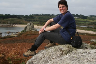
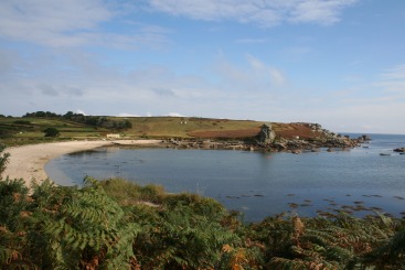
The last couple of photos are from the beach at Porth Herrick, including the obligatory “I was here” photo (and I actually used the tripod this time!). As you can see it turned out to be a lovely afternoon, to the extent that I actually paddled at the beach when I got back to Hugh Town. In fact, it had been lovely in the morning too, with one of the highlights being a trip out to a “frying pan island” (i.e., one that can be cut off by the tide) to find a cache out at the end. It was sufficiently deserted to warrant singing “I am a pirate king” at the top of my voice, so I did. It was all rather Scilly, really … and therefore appropriate.
There are some more photos of the day’s activities here.
 Helen Chick
Oh, I’m loving your blog! I think the impossible thing was finding a white sandy English beach – although I note you had to go offshore to get it. All the English beaches I remember were pebbles. The English don’t seem to go to the seaside to get wet. And I actually saw a man in Whitby (Yorkshire) with a knotted hankie on his head!
Am I allowed to pass your blog address on to people you don’t know but who appreciate wit and photography? Or are you strictly by invitation only? And if the latter, can I at least let Sally know about your blog?
Keep safe, and keep packing as much into every minute of England that you can!
I was just consulting my copy of Megalithic Mysteries- An Illustrated Guide to Europe’s Ancient Sites by Michael Balfour (1992), and found Innisidgen Carn… only to find the photo in the book mirrored! “That’s odd”, I thought, but with all the images in this tome I guess it is bound to happen! I turned to Bant’s Carn, and guess what? Mirrored also!
Unless someone has moved the stones in mirror formation in the last 17 years… yeah… that’s it!
I still managed to drool on the book, and my netbook!