 Helen Chick

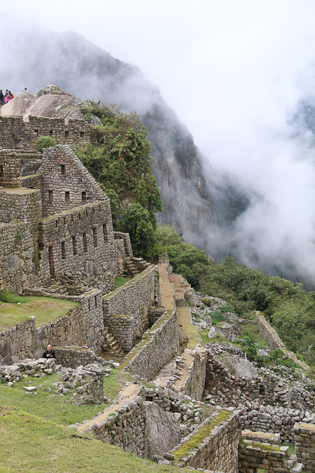
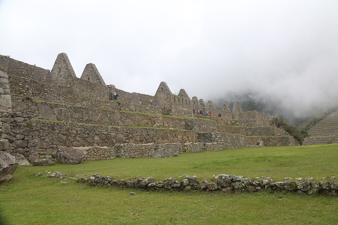
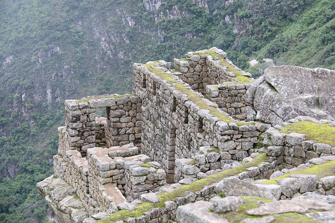
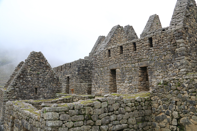
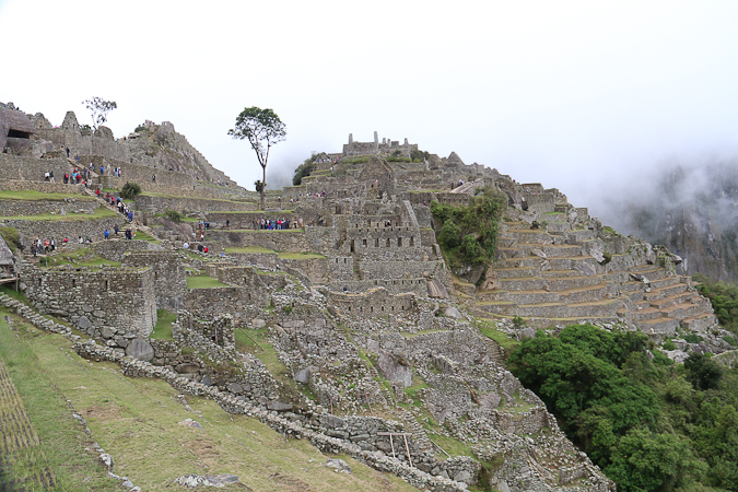
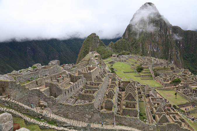
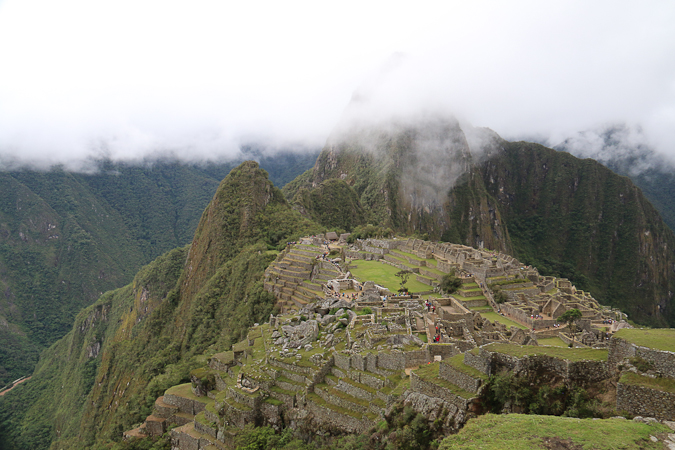
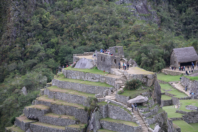
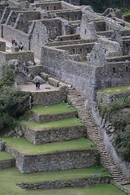
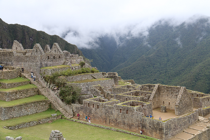
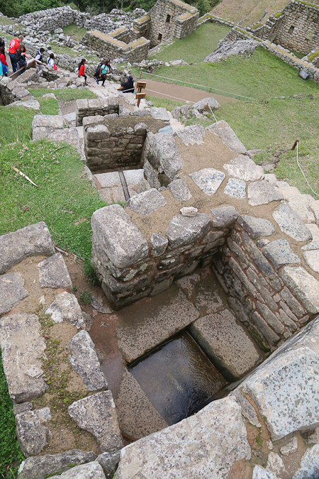
The morning tour with Cocaman had taken us around the lower part of the site, which was the hub for the city and had most of the significant buildings. In addition to the photos presented in the Pt 1 post, I took quite a few other photos of the less “important” structures, all of them so remarkably well constructed, and cascading down the hill in such a way that they seemed part of the mountains themselves.
After our group tour ended, and we’d farewelled Cocaman (and Jess and Juan), Cath and I then went out and came back in again (managing people flow on such a steep site is tricky, and you get funnelled out before you’ve seen everything, so you’re allowed to re-enter and take a different route). This gave us a chance to do some exploring on our own.
This was mostly enjoyable, although it was hard to ignore the large number of selfie-sticks being waved about by tourists who seemed more intent on taking photos of themselves rather than appreciating the site for what it was.
 Adele came back with a couple of selfies to acknowledge the travels of a peripatetic penguin, and I admit to taking a couple of shots with me in them, but there was so much grandeur and impressive construction from the ruins themselves that I wanted to capture and feature for their own sake; NOBODY wants me in those shots, especially me!
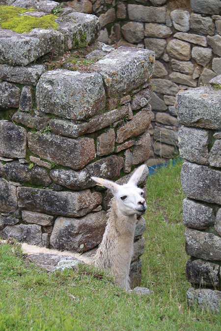
Fortunately the site is big enough that you can either distance yourself from people or find quiet little corners to capture some of the atmosphere, and you’ll almost certainly find one of the resident llamas.
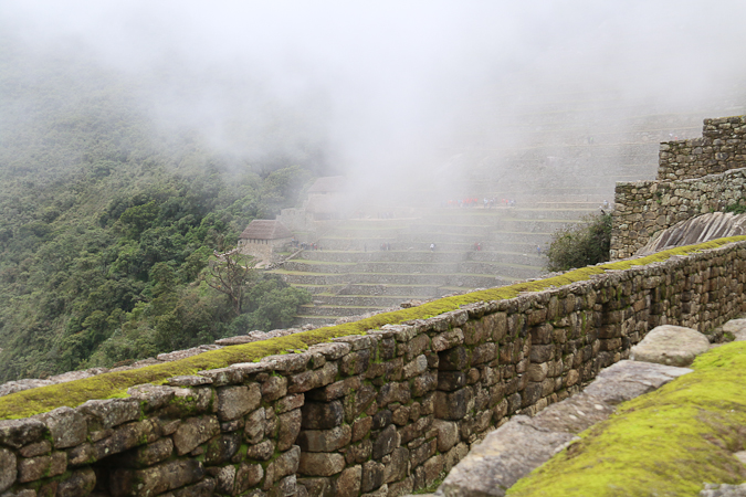
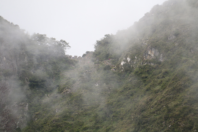
At times the mist cleared enough that we could see back up to Intipunku (the Sun Gate) where we had been so relatively early in the morning.
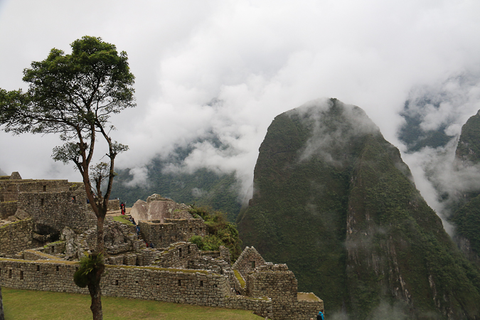
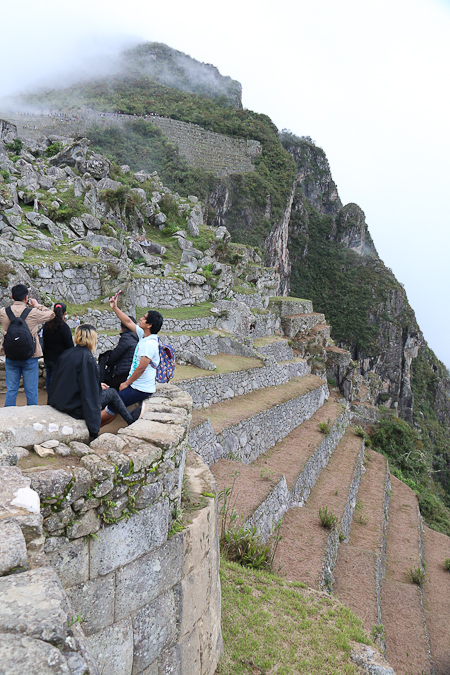
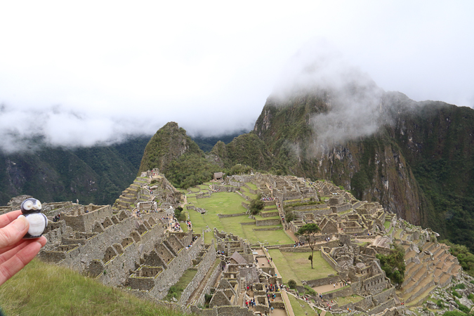
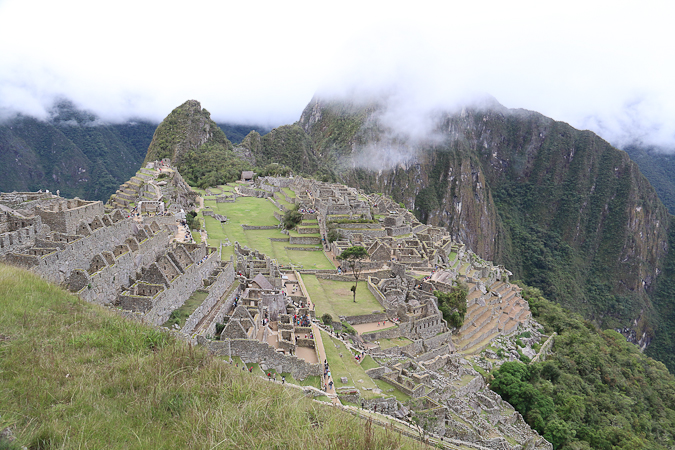
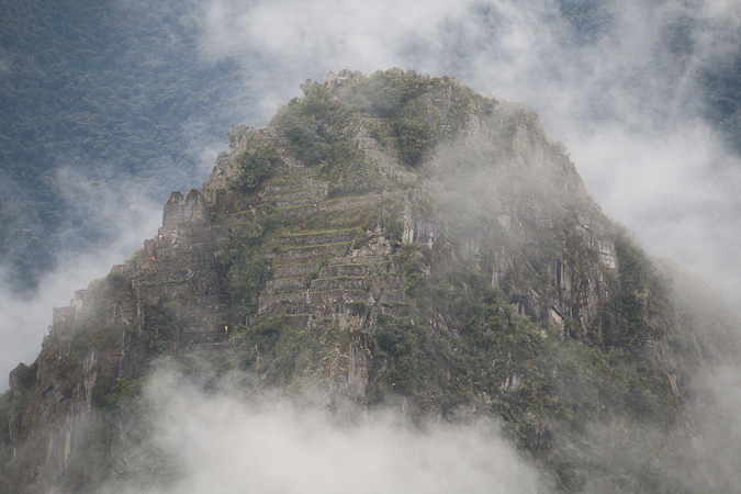
One of the dominant features of the site — when the mist cleared enough — was the stunning peak of Wayna Picchu, which towers steeply over Machu Picchu, and has its own ruins perched precariously near the summit. This has an impossibly steep track leading up to it that people were climbing. We decided not to tackle it due to our own physical limitations (our leg muscles were very sore) and the vertiginous nature of the route (frankly, I suspect I’d have been a tad scared) and there are a limited number of tickets available to do it (and queuing just didn’t seem worth it).
Instead, we were content to wander at our own pace and simply marvel at what was there.
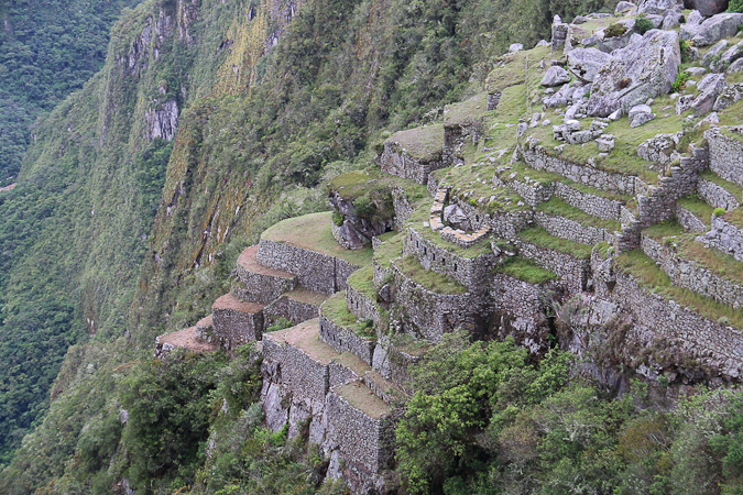
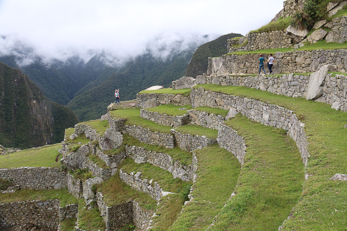
The terraces, stairs, buildings and water features were, simply, awe-inspiring.
We left the site around 12:30, and took the rather hair-raising bus trip descending the multiple switchbacks that take you down to the river, and finally into the tourist town of Aguas Calientes (13°9.3’S 72°31.5′ W).
We did a little exploring here, and then headed to the restaurant where we were to collect our additional bags that the porters had been carrying. Cocaman was here, so we shouted him a drink and had ourselves icecream and milkshakes to celebrate our achievement. By this time it had started raining again, so we couldn’t be bothered doing much more exploring, instead heading to the railway station to sit and wait for our train.
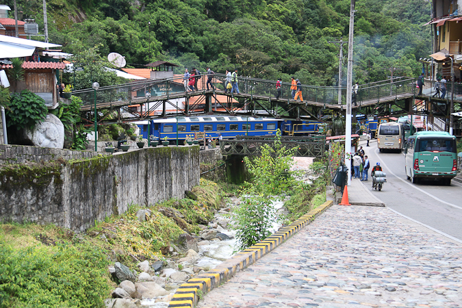
The train, which took us on the 1.5 hour trip from Aguas Calientes to Ollantaytambo (as there is no road), was quite full and we were jammed into our seats with our gear. We could see how much higher the river was compared to what it had been at the start of our walk, and we also passed the early stages of the Inca Trail that we’d done so seemingly long ago so we could review where we’d been. At Ollantaytambo we were met by a van for the journey back to Cusco.
And then it was nice to check back into our hotel, have a long shower, change into clean clothes and reflect on all that we had seen and accomplished. I’m really glad we made the effort to do the actual walk, because it made it a much richer, more intense and personal experience.
But, my word, I’m going to be stiff and sore tomorrow!
Latest comments