 Helen Chick

Today we started the Inca Trail, the other “big event” item on the Big Trip.
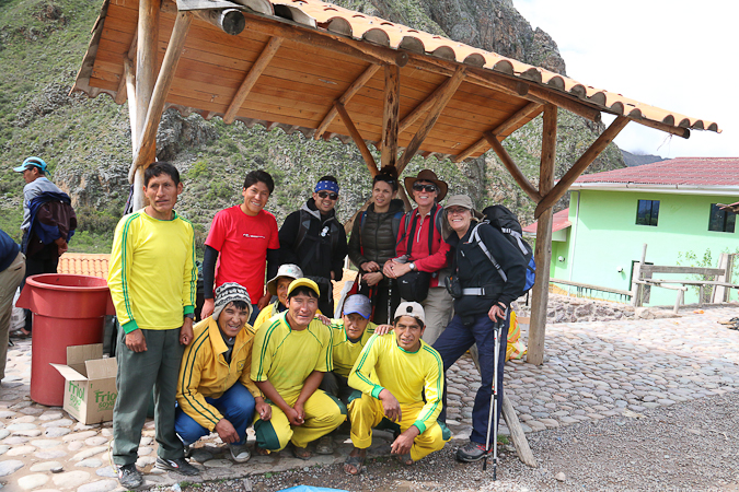
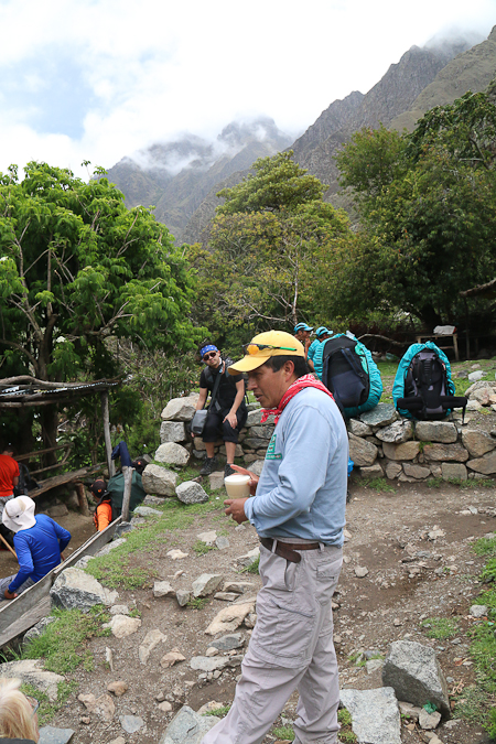
It was an early start with a 5:15am pick up, and, after collecting the porters, and Jess and Juan from Canada who were the other two travellers in our nice small party, we finally got underway. A cold and erratic van trip then ensued, with a breakfast stop at a rather unprepossessing place, a passage through the craziness that is Ollantaytambo, and a bouncing ride along a very rough road alongside the Urubamba River. We arrived at S 13°12.9′ W 72°22.9′, the little hamlet of Piskacucho which is the “KM 82” mark for the Inca Trail where most trekking tourists depart. Here our little group got organised, in amongst crowds of others clustered in groups identified by the soon-to-become-familiar coloured team outfits of the different trekking companies.
And, yes, there are seven porters including a cook (plus our guide, who will be shown later) supporting the four of us. (There were going to be two additional tourists but they pulled out at the last minute.) The porters were amazing: they’d overtake us on the uphills, jog the downhills, and have everything set up when we arrived at our lunch stops and evening campsites. Their packs are supposed to weigh at most 25kg, which is massive enough, but some of them looked rather heavier. And we are not talking modern packs with well-designed ergonomic harnesses; they were, essentially, sacks with straps.
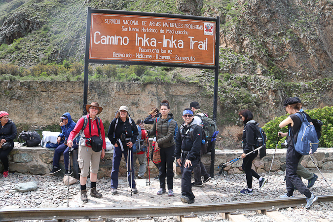
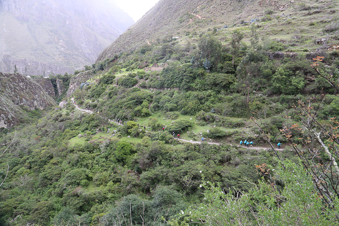
We’d barely started walking along the track when we had to stop and queue at the first control point and have our tickets stamped prior to crossing the river. There is a limit on the number of tourists and porters on the trail each day (500 in total), and all tourists must be accompanied by guides.
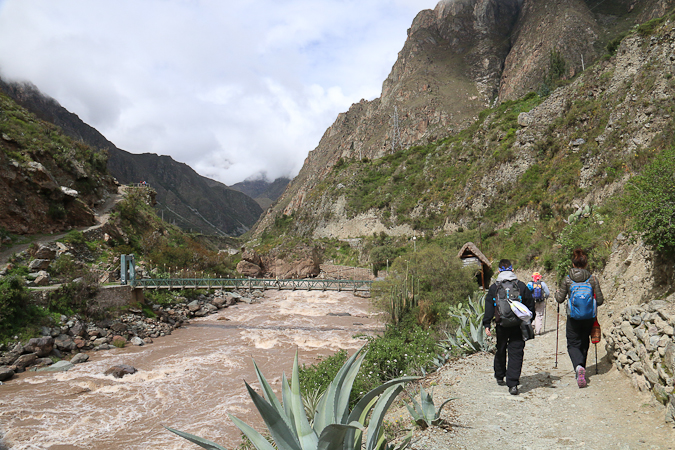
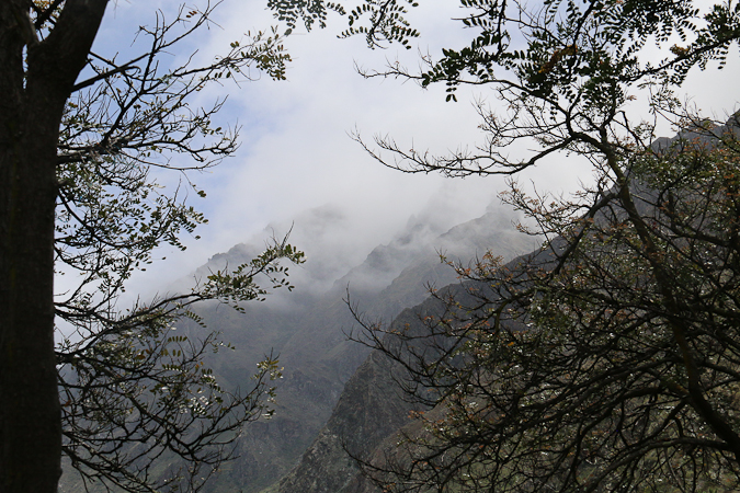
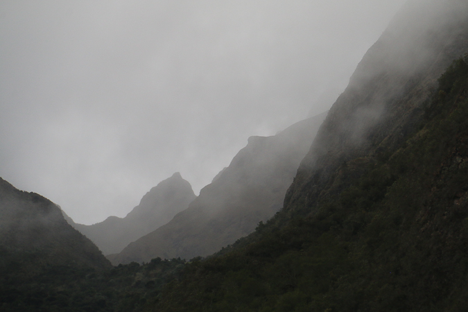
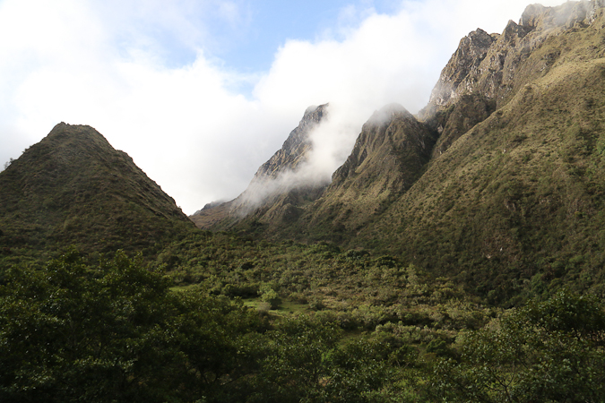
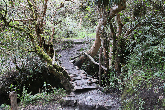
The first part of the Inca Trail basically follows alongside the Urubamba River, before following its tributary Kusichaka Stream, and the path is mainly undulating though gradually working upwards, with a few steep pitches along the way. The surrounding peaks on either side of the valleys were often shrouded in clouds. The early part of the trail still links a few small communities, each comprising perhaps a dozen or so small-holdings, and which offer the occasional toilet (we’re now at the “squat” toilet level of facilities, which was a bit of a problem for my knees).
Our guide, Saul (pronounced Sa’ool), was better known to everyone on the trail as Cocaman. His Quechuan heritage included a significant understanding of old rituals and history, and, as his nickname suggests, he was a regular user of the coca leaf for both medicinal and worship purposes.
At one of the earlier stops along the trail he introduced chicha to those who were of a mind to try a local alcoholic beverage; this is a fermented corn drink. If you partook, some of it had to be offered to Pachamama, the mother earth goddess, by pouring a little onto the ground.
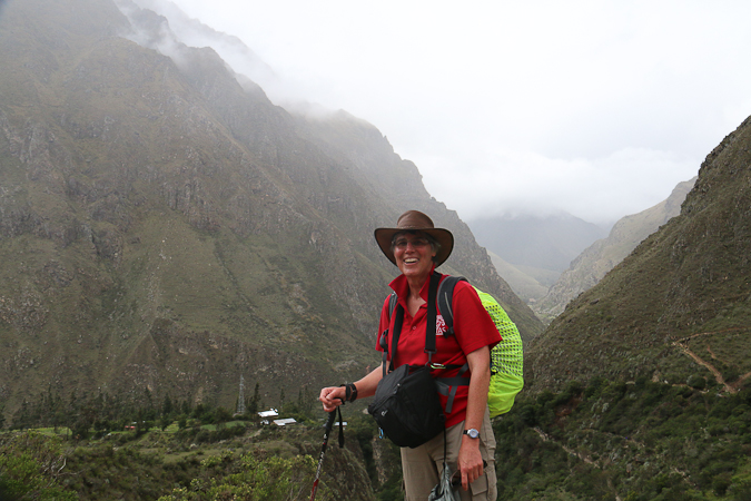
The weather was mild and lightly drizzly — enough to worry about keeping the camera dry, but not enough to bother putting on any wet weather gear (apart from my pack cover).
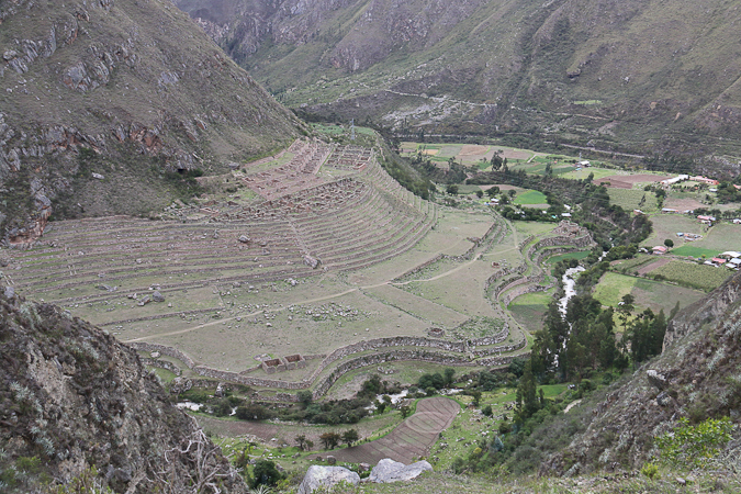
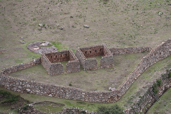
As the trail turned away from the Urubamba River and headed up the valley of the Kusichaka River we could see the extensive ruins of Patallacta below us (S 13°13.9′ W 72°25.5′), with extensive terraces and the ruins of residential accommodation.
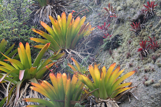
Higher up the valley the vegetation changed and we could see bromeliads growing on the rocky slopes.
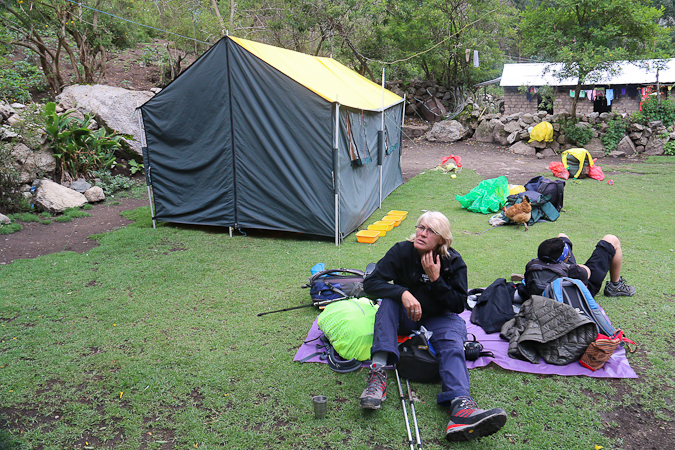
At lunchtime I was surprised to see that we had a big tent set up for us, and we had a good substantial meal prepared and served by our cook and porters.
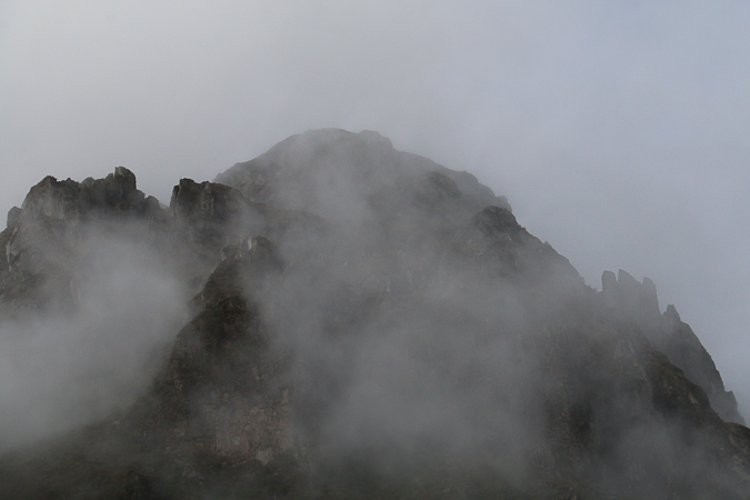
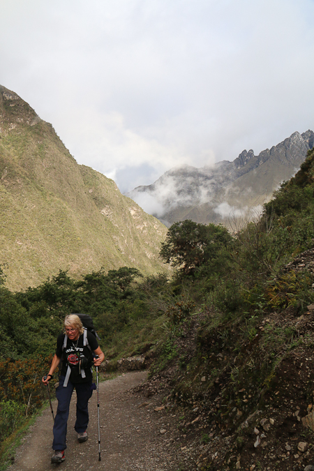
From lunch the track started to climb a bit more, until we reached Wayllabamba, the last village on the trail. The track then climbs 300m in perhaps a couple of km, and I found this slow going, but doable. The peaks were dramatic with the mist coming and going, and occasionally we had glimpses of the bosom-shaped profile of Warmi Wañusca, or Dead Woman’s Pass, the highest point on the Inca Trail.
Eventually we arrived at our campsite at Ayapata (S 13°15.5′ W 72°27.7′), at an altitude of 3300m. Our porters had our tents set up, and, as darkness fell, we tucked into a hearty meal. There was way too much food, possibly a consequence of the missing two members of the party, and it was easy to feel a bit guilty for not getting through more of it.
So, we have made it through the first day of the hike — some 14.5km — without too many adverse effects. I think the days we had at altitude in Puno and Cusco which allowed us to acclimatize were helpful. We went to bed anticipating an early start in the morning … so that we can tackle the dreaded Dead Woman’s Pass.
Latest comments