 Helen Chick

Brace yourselves for more photographs. I took heaps today, I still had heaps left after I threw out heaps, and I liked heaps among what remained … and so I am inflicting heaps upon you. Each successive heap is, fortunately, smaller than its predecessor, but given that I started with 250 you can see why you could be in trouble. Gone are the days when one roll of 36 exposure film had to last me two or three excursions, although there were occasional extravagances where I indulged myself with a whole roll for just one excursion, and the rarest of expeditions where I actually took along more than one roll. Anyway, enough of reminiscing, on with the show.
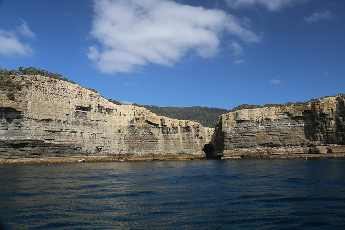
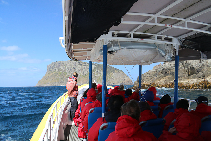
I had promised my parents a Christmas present — and myself a no-reason-required treat — of a cruise along the Tasman Peninsula. All that was required was to await the confluence of a free day for all three of us and a good weather forecast, preferably after the school holidays had ended, and hopefully before summer did. Today was that day, and so we headed down to Port Arthur, to be bussed back up to Eaglehawk Neck to board our yellow boat for a cruise along the magnificent cliffs of the far south-east coast.
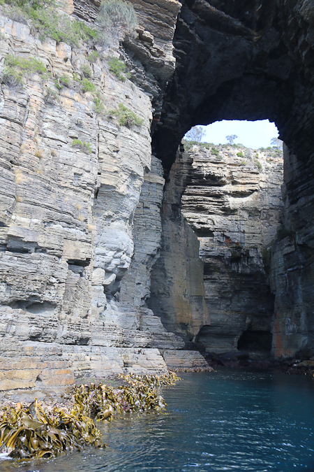
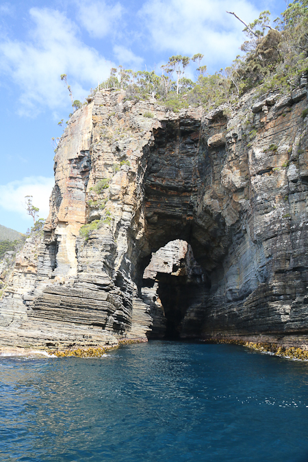
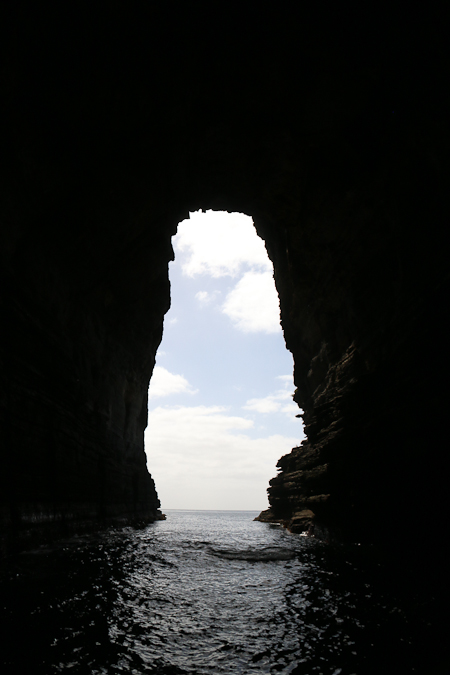
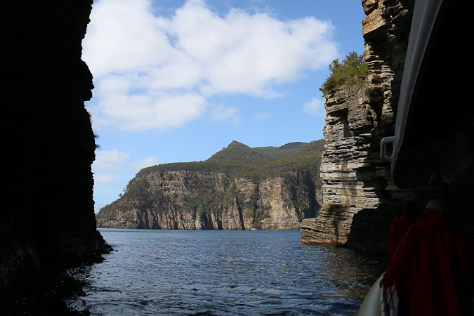
At the Eaglehawk end of the trip the features were sea caves in the Permian mudstone. Our boat was small enough — as were the seas — that we could nose into quite a few of the landforms, including the famous Tasman Arch, seen in the second photo below.
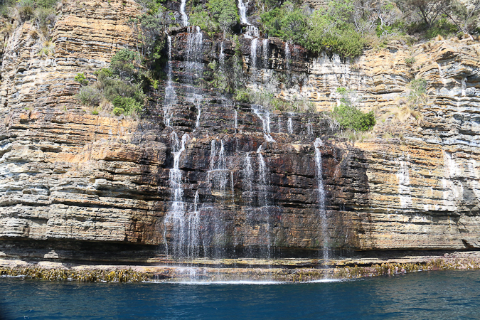
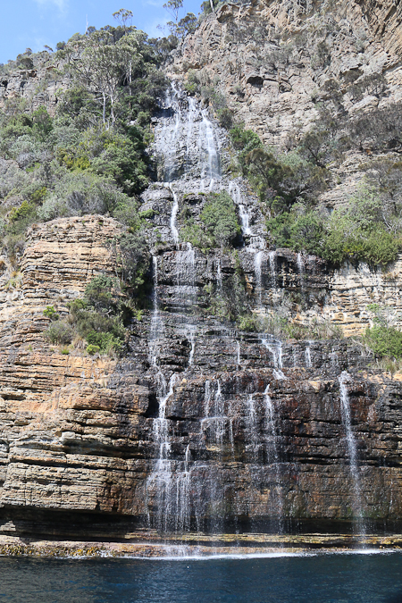
In Waterfall Bay recent rain meant that water was flowing over the waterfall that plunges from the cliff into the sea (it is just visible to the right of the central peak in the photo below).
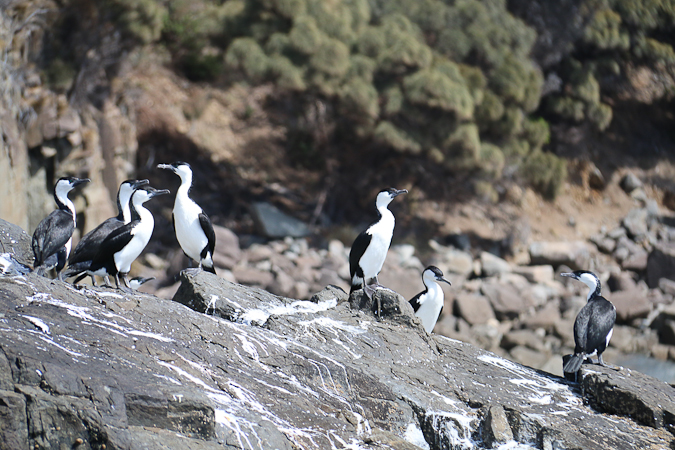
There was plenty of bird-life to see. There were cormorants …
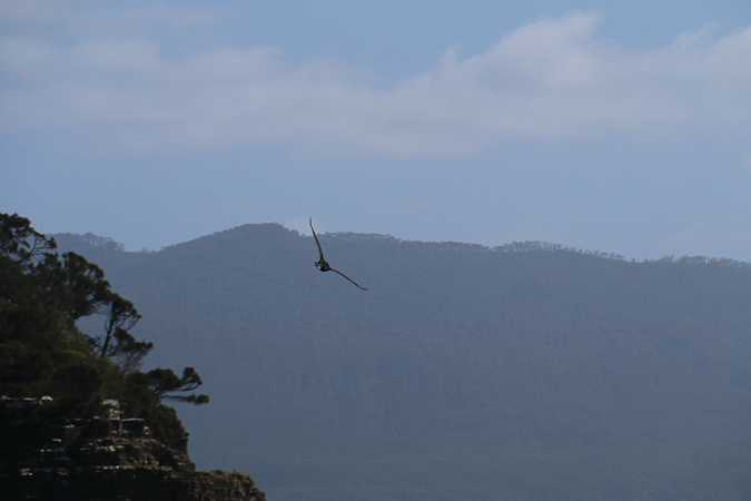
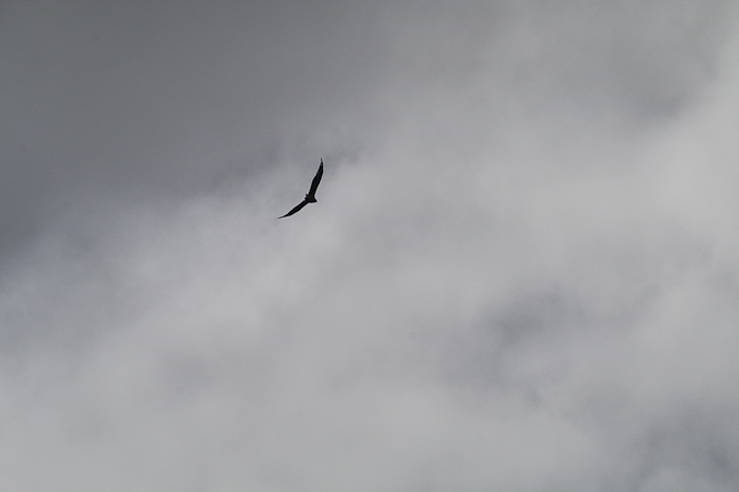
and sea-eagles at various times …
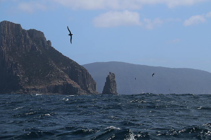
lots and lots of short-tailed shearwaters (aka mutton birds), which make an amazing annual journey to Russia and back …
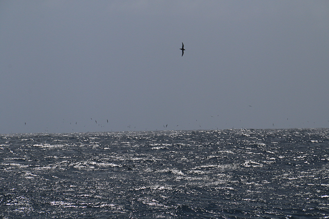
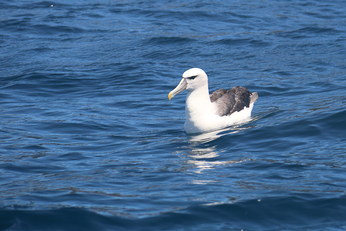
and, on our return, we were fortunate to get a very close view of an albatross. (“What flavour was it?” I hear you ask. Albatross flavoured, of course.)
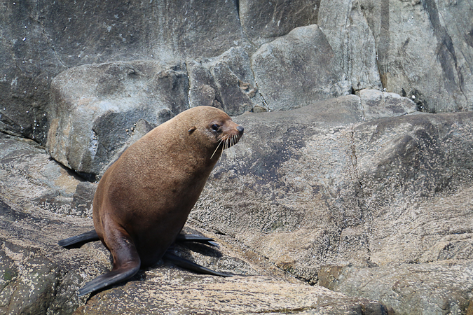
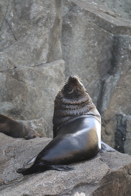
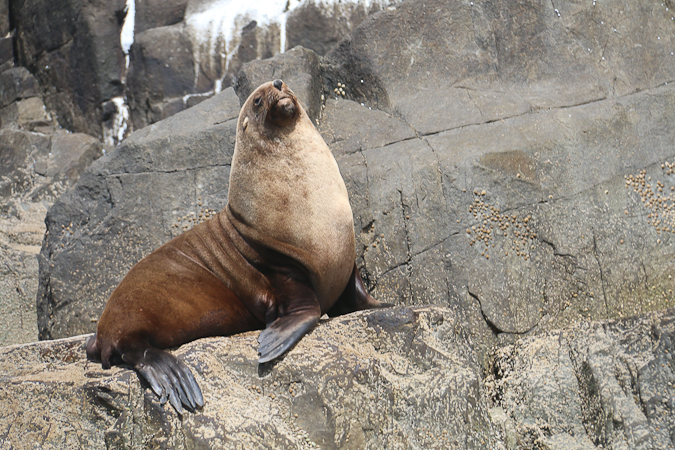
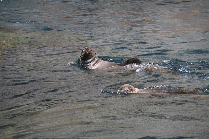
We were also treated to an abundance of seals, both Australian and long-nosed/New Zealand fur seals. They were cute, big and moderately smelly.
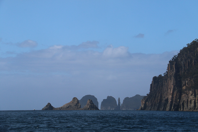
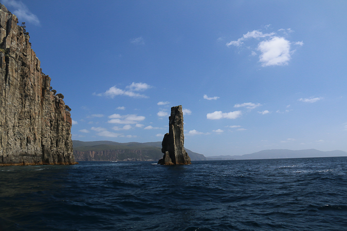
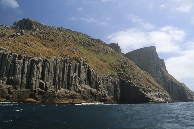
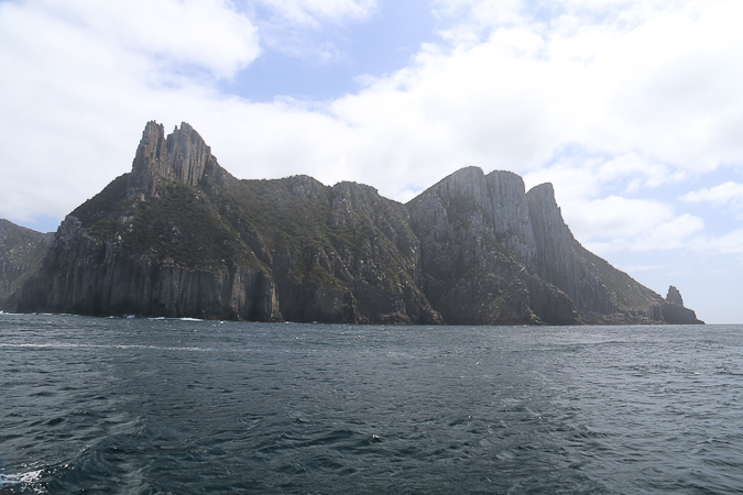
As you head south the dominant rock changes to Jurassic dolerite, with its striking columns and outcrops. We could see Cape Hauy for most of the trip, with the remarkable Candlestick sea stack rising out of the ocean between the cape and the islands off the end known as the Lanterns.
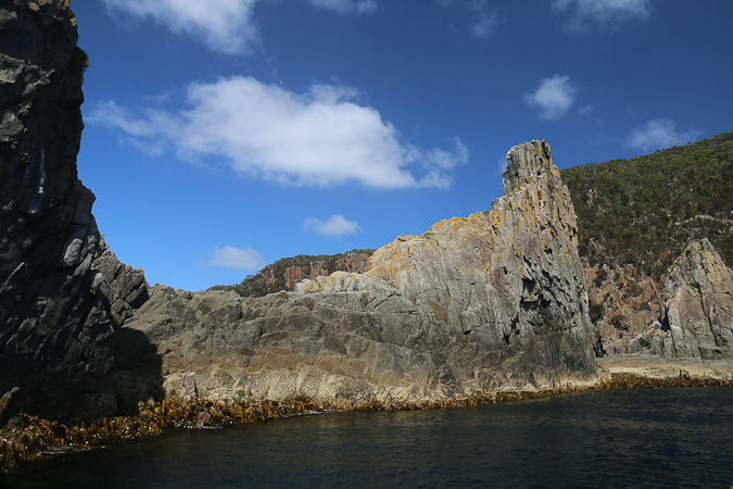
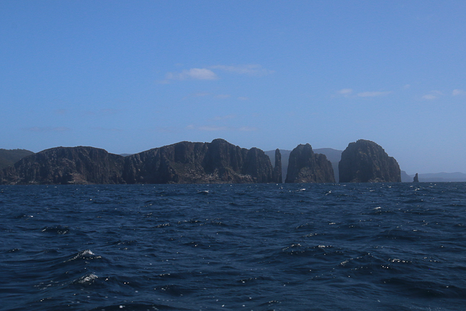
There is another smaller stack right off the end of the Lanterns, and the gap between it and the cliffs is big enough for the boat to navigate with ease.
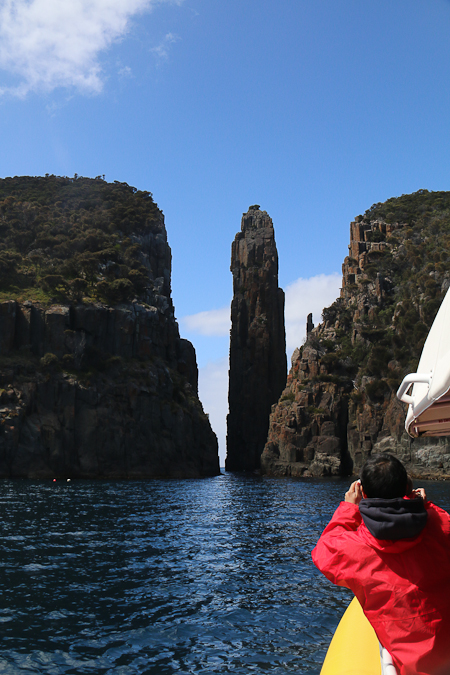
Here is the view on our way back for a different perspective.
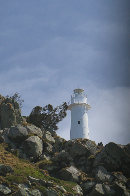
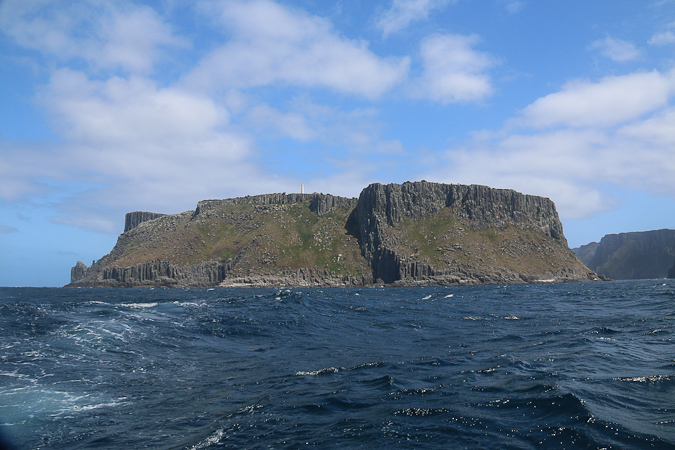
Our southern-most point was Tasman Island, off the end of Cape Pillar (where I’d hiked with Scouts nearly two years ago). Here the swell and the south-westerly breeze meant that we had to forgo the run up to Port Arthur, instead returning to Eaglehawk Neck but a little further out to sea which allowed us to see the shearwaters.
 We were, however, able to get good views of the base of Tasman Island — which is where some of the seals were and which is so steep that landing supplies in the days before helicopters was very difficult and relied on a basket on a flying fox system to get from an offshore rock to the platform shown below, and then there was a steep haulage way up the cliffs.
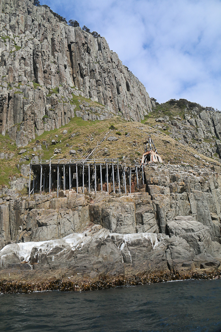
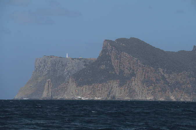
The lighthouse is now automated and the island no longer inhabited.
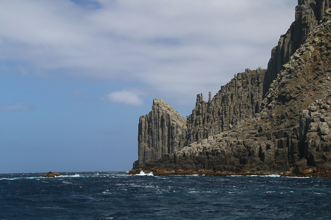
The dolerite coastline is rugged and dramatic, and the cliffs at the end of Cape Pillar, seen to the right of Tasman Island in the photo below are, at 300m, the tallest in the southern hemisphere.
Here you can see the cliffs at the end of Cape Pillar: the Blade is the jagged ridge on the left (there is a track out to the top of it, finishing at the right of the cleft, which I climbed on the previously mentioned Scout hike)
Tasman Island makes an important landmark for the Sydney-Hobart yachties as they race to Hobart after Christmas each year, but although it indicates they are getting closer to Hobart it also marks a turn to the west, and some of the weather across the southern end of the Tasman Peninsula and in the aptly named Storm Bay can get pretty foul (indeed, that’s why we went back the way we’d come today, as the eastern coast was generally sheltered from the worst of the wind and was only experiencing a relatively gentle rolling swell).
Like its Bruny Island counterpart — with which there are striking resemblances of geography — this is a trip well worth doing. We had a great day, seeing some truly remarkable scenery.
It’s a wonderful trip – Ali and I did it a few years ago. We had colder weather but were able to finish the trip in Port Arthur. Whenever I see seals now I think of Martin (brother of Richard) Flanagan’s wonderful image of them lolling about ‘like stuffed socks’. We saw dolphins but no whales.
I really want to do the Bruny Island trip too now.
But do stuffed socks loll? To me, lolling isn’t totally inert … just nearly so! (And seals can be quite quick and active when they’re motivated. It’s getting motivated that may be an all too familiar issue! 😉 )
Mate! What a beautiful scene that was just off the coast, I imagine the surf would be great?